Nothing Special   »   [go: up one dir, main page]

2018

NY7808 : Looking northwest from Merrygill Viaduct

taken 7 years ago, near to Hartley, Cumbria, England
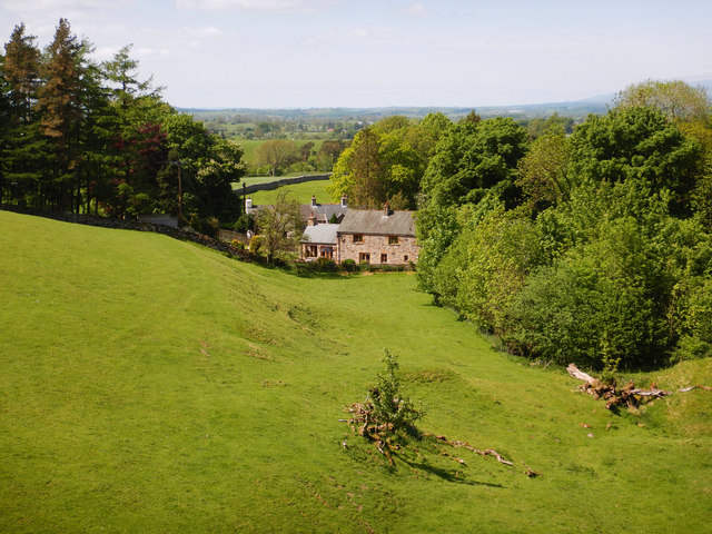
Looking northwest from Merrygill Viaduct
Looking down over pasture to the outlying farms of Hartley, from the parapet of Merrygill viaduct (now owned by the Northern Viaduct Trust). Hartley Beck is the stream crossed and this flows among the trees to the right of the photo, on its way down to the River Eden through rich farmland. Having been bothered by the RAF earlier in the day, persistently flying noisy circles over the Warcop training area, we were treated to a much smaller flying display here, as a young man was piloting a small drone taking aerial footage over the viaduct. His approach to safety was admirable, with lots of warning signs so that we weren't surprised by the remotely operated aircraft.

Creative Commons Licence [Some Rights Reserved]   © Copyright Andy Waddington and licensed for reuse under this Creative Commons Licence.
Geographical Context: Lowlands Grassland Woodland, Forest Category: Pastureland Category: Pastureland
This photo is linked from: Automatic Clusters: · Merrygill Viaduct [21] · Looking [5] · Hartley Beck [4] ·
1:50,000 Modern Day Landranger(TM) Map © Crown Copyright
+
+
1:50,000 Modern Day Landranger(TM) Map © Crown Copyright
TIP: Click the map for more Large scale mapping
Grid Square
NY7808, 55 images   (more nearby 🔍)
Photographer
Andy Waddington   (more nearby)
Date Taken
Tuesday, 22 May, 2018   (more nearby)
Submitted
Friday, 15 June, 2018
Subject Location
OSGB36: geotagged! NY 7829 0845 [10m precision]
WGS84: 54:28.2568N 2:20.1896W
Camera Location
OSGB36: geotagged! NY 7840 0830
View Direction
Northwest (about 315 degrees)
Clickable map
+
NW N NE
W Go E
SW S SE
Image Type (about): geograph 
This page has been viewed about 54 times
You are not logged in | login | register