Nothing Special   »   [go: up one dir, main page]

2018

SD9498 : Dropping down into Dyke Heads

taken 7 years ago, near to Ivelet, North Yorkshire, England
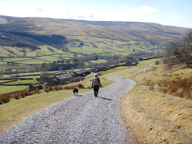
Dropping down into Dyke Heads
The track above the right bank of Gunnerside Gill is maintained in good condition for vehicles right up onto Gunnerside Moor. Here it has turned away from the slope above the Gill, to descend the south-facing hillside to the road between Dyke Heads and Ivelet. Across the dale, there are still a few patches of snow on the north-facing slopes of Oxnop Side. Swaledale's characteristic field barns are fewer in number here than further down the dale, but several can still be seen scattered between the more modern farm buildings.

Creative Commons Licence [Some Rights Reserved]   © Copyright Andy Waddington and licensed for reuse under this Creative Commons Licence.
Geographical Context: Uplands Farm, Fishery, Market Gardening Moorland Category: Bridleway Track Category: Track > Track
This photo is linked from: Automatic Clusters: · Fields [9] · Track [7] · Dale [5] · Dyke Heads [5] · Ivelet and Gunnerside [5] ·
1:50,000 Modern Day Landranger(TM) Map © Crown Copyright
+
+
1:50,000 Modern Day Landranger(TM) Map © Crown Copyright
TIP: Click the map for more Large scale mapping
Grid Square
SD9498, 64 images   (more nearby 🔍)
Photographer
Andy Waddington   (more nearby)
Date Taken
Thursday, 5 April, 2018   (more nearby)
Submitted
Sunday, 10 June, 2018
Subject Location
OSGB36: geotagged! SD 9431 9850 [10m precision]
WGS84: 54:22.9177N 2:5.3467W
Camera Location
OSGB36: geotagged! SD 9434 9852
View Direction
West-southwest (about 247 degrees)
Clickable map
+
NW N NE
W Go E
SW S SE
Image Type (about): geograph 
This page has been viewed about 53 times
You are not logged in | login | register