Nothing Special   »   [go: up one dir, main page]

2018

SD7375 : Flying off Ingleborough

taken 7 years ago, near to Chapel-le-Dale, North Yorkshire, England
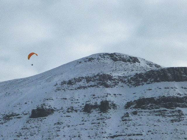
Flying off Ingleborough
I chatted to the pilot quite close to the summit as he hauled his large pack up. He was quizzing me about the wind speed up there - it's better to have a breeze to provide uplift as it moves up the sides of the mountain. Unfortunately, it was a relatively calm day and he sank down the side quite rapidly - I doubt his flight lasted more than a few minutes as he headed towards open pastures near the Hill Inn. Still, the views of the Black Shiver face of Ingleborough must have been quite spectacular.

Creative Commons Licence [Some Rights Reserved]   © Copyright Karl and Ali and licensed for reuse under this Creative Commons Licence.
Geographical Context: Uplands Sport, Leisure Air, Sky, Weather Rocks, Scree, Cliffs Barren Plateaux other tags: Paraglider Paragliding Snowy Mountain Crags Click a tag, to view other nearby images.
This photo is linked from: Automatic Clusters: · Black Shiver Face of Ingleborough [2] · Summit [2] ·
1:50,000 Modern Day Landranger(TM) Map © Crown Copyright
+
+
1:50,000 Modern Day Landranger(TM) Map © Crown Copyright
TIP: Click the map for more Large scale mapping
Grid Square
SD7375, 18 images   (more nearby 🔍)
Photographer
Karl and Ali   (more nearby)
Date Taken
Wednesday, 7 February, 2018   (more nearby)
Submitted
Tuesday, 13 February, 2018
Subject Location
OSGB36: geotagged! SD 7393 7506 [10m precision]
WGS84: 54:10.2399N 2:24.0501W
Camera Location
OSGB36: geotagged! SD 7359 7570
View Direction
South-southeast (about 157 degrees)
Clickable map
+
NW N NE
W Go E
SW S SE
Image Type (about): geograph 
This page has been viewed about 33 times
You are not logged in | login | register