Nothing Special   »   [go: up one dir, main page]

2015

SX5474 : The Ruins of Hucken Tor Farm

taken 10 years ago, near to Merrivale, Devon, England
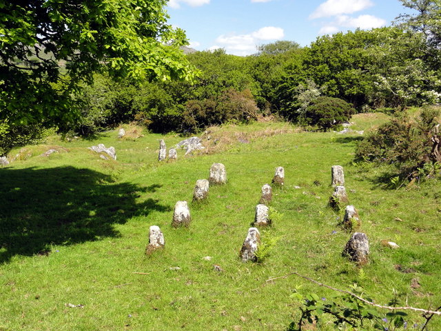
The Ruins of Hucken Tor Farm
This was a farm in medieval times. The rows of low granite posts in the foreground are 'stooks', They formed the foundation on which a hay or grain store would have been built and served to keep the building floor above the often soggy ground and helped to keep it free of vermin.

Creative Commons Licence [Some Rights Reserved]   © Copyright Tony Atkin and licensed for reuse under this Creative Commons Licence.
Geographical Context: Farm, Fishery, Market Gardening Derelict, Disused Primary Subject: Ruin
1:50,000 Modern Day Landranger(TM) Map © Crown Copyright
+
+
1:50,000 Modern Day Landranger(TM) Map © Crown Copyright
TIP: Click the map for more Large scale mapping
Grid Square
SX5474, 43 images   (more nearby 🔍)
Photographer
Tony Atkin   (more nearby)
Date Taken
Sunday, 7 June, 2015   (more nearby)
Submitted
Sunday, 10 September, 2017
Subject Location
OSGB36: geotagged! SX 549 741 [100m precision]
WGS84: 50:32.9167N 4:2.9569W
Camera Location
OSGB36: geotagged! SX 549 740
View Direction
NORTH (about 0 degrees)
Clickable map
+
NW N NE
W Go E
SW S SE
Image Type (about): geograph 
This page has been viewed about 95 times
You are not logged in | login | register