Nothing Special   »   [go: up one dir, main page]

2017

SX0070 : Shooting Range Platform

taken 8 years ago, near to Burlawn, Cornwall, England

This is 1 of 2 images, with title Shooting Range Platform in this square
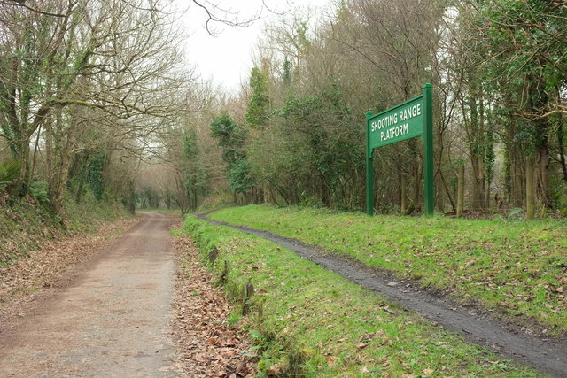
Shooting Range Platform
"The platform was built around 1880 to serve a firing range with trains only stopping with written permission from the army. Periods of use centred around the Boer and World War One. Troops were always sent by rail as there was no other means of access. Use of the range ceased after this although the platform, with its cinder surface, was maintained into the 1950s. " LinkExternal link . The rifle range in question ran along the strip of land between the railway line and the River Camel.

Creative Commons Licence [Some Rights Reserved]   © Copyright Derek Harper and licensed for reuse under this Creative Commons Licence.
This photo is linked from: Automatic Clusters: · River Camel [9] · Railway Line [5] · Shooting Range Platform [4] Other Photos: · Camel valley Title Clusters: · Shooting Range Platform [2] ·
1:50,000 Modern Day Landranger(TM) Map © Crown Copyright
+
+
1:50,000 Modern Day Landranger(TM) Map © Crown Copyright
TIP: Click the map for more Large scale mapping
Grid Square
SX0070, 21 images   (more nearby 🔍)
Photographer
Derek Harper   (more nearby)
Date Taken
Saturday, 21 January, 2017   (more nearby)
Submitted
Wednesday, 7 June, 2017
Subject Location
OSGB36: geotagged! SX 0050 7078 [10m precision]
WGS84: 50:30.1652N 4:48.8784W
Camera Location
OSGB36: geotagged! SX 0050 7079
View Direction
South-southeast (about 157 degrees)
Clickable map
+
NW N NE
W Go E
SW S SE
Image Type (about): geograph 
This page has been viewed about 53 times
You are not logged in | login | register