2014
NX3946 : Millers Cairn
taken 10 years ago, near to Airyhassen, Dumfries And Galloway, Scotland

Millers Cairn
Millers Cairn is a crannog which was excavated in 1864 when Dowalton Loch was the drained.
The following is the description from the site record on the Canmore website of the Royal Commission on the Ancient and Historical Monuments of Scotland: (Link (Archive Link
 ) )
) )
"Miller's Cairn, a crannog, is so called from its having been a mark of the levels when Dowalton Loch was drained by cuts for feeding nearby mills. It was still surrounded by water when visited by Lord Percy in 1863, when it was seen to comprise a surface of stones and soil over a substructure of oak piles, hazel branches and ferns. The crannog was surrounded by oak piles, and lines of piles, to support a causeway, led from it to the shore. A hearth was found on it, as well as a small piece of bronze, while a Romano-British bronze basin was found in the loch nearby. Both are in NMAS."
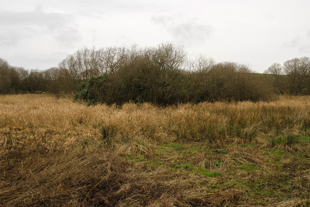
Today Millers Cairn can be accessed from the south by picking a careful path through the surrounding marsh, although a thick and virtually impenetrable covering of rhododendron makes exploring its surface almost impossible.
The following is the description from the site record on the Canmore website of the Royal Commission on the Ancient and Historical Monuments of Scotland: (Link
"Miller's Cairn, a crannog, is so called from its having been a mark of the levels when Dowalton Loch was drained by cuts for feeding nearby mills. It was still surrounded by water when visited by Lord Percy in 1863, when it was seen to comprise a surface of stones and soil over a substructure of oak piles, hazel branches and ferns. The crannog was surrounded by oak piles, and lines of piles, to support a causeway, led from it to the shore. A hearth was found on it, as well as a small piece of bronze, while a Romano-British bronze basin was found in the loch nearby. Both are in NMAS."
Today Millers Cairn can be accessed from the south by picking a careful path through the surrounding marsh, although a thick and virtually impenetrable covering of rhododendron makes exploring its surface almost impossible.