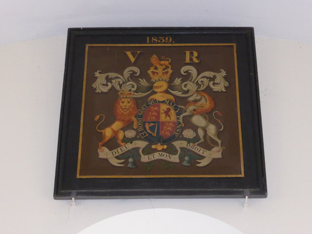
SK9913 : All Saints Church: Loyal Hatchment
taken 10 years ago, near to Pickworth, Rutland, England

1839 was the year Michael Faraday publishes "Experimental Researches in Electricity", and was two years after Victoria assumed the throne. It is not clear what the significance of the year is.
An Italianate church built in the early 19th century, to replace the former medieval church destroyed during the Battle of Losecote Field in 1470. It is a grade II listed building.
The church was built by the Rector of Casterton, the Rev. Richard Lucas, in the early 19th century, around the same time as the construction of the Methodist chapel and perhaps in direct competition with the nonconformists. The village was substantially rebuilt around this time by the landowner, the Earl of Exeter, who donated the land for this church. The building was funded out of a legacy of Joseph Armitage, of Wakefield.
The interior is plain with the original box pews. These have been reversed at some point in the 19th century; the pulpit and altar were originally under the West window, where the font now stands. The congregation now faces east.
A guidebook in the church says it was built in 1824, but the Peterborough Diocese website for the church says 1816. The Wikipedia page says 1821, and the English Heritage listing, quoting the Victoria County History, says 1822. This latter date is also given on a memorial in the church to Joseph Armitage as the date of the bequest, so the construction probably occurred a little later. The modern registers date from 1812, when some unknown building was being used as a chapel-of-ease by the Casterton church.
The English Heritage listing is at Link
The Victoria County History is at Link