Nothing Special   »   [go: up one dir, main page]

2016

NS3875 : Havoc Grassland

taken 9 years ago, near to Dumbarton, West Dunbartonshire, Scotland

This is 1 of 3 images, with title Havoc Grassland in this square
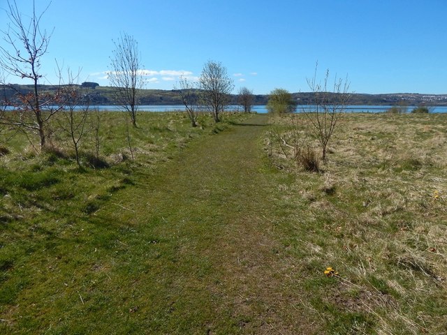
Havoc Grassland
Havoc Grassland
For details on the far shore of the Clyde, at the left, see NS3874 : Clyde foreshore near Brucehill. Port Glasgow is at the far right.
Brucehill Cliffs and Havoc Grassland

The site is, as of 2015, a Local Nature Conservation Site (LNCS), and a proposed Local Nature Reserve (LNR). It is host to a variety of butterflies and grassland plants. The area is a raised beach, with former sea-cliffs now standing inland. Between the cliffs and the Clyde shore is Havoc Grassland; maps from shortly before the Second World War show "Allotment Gardens" there. The adjacent shore is part of a Site of Special Scientific Interest (SSSI).


Creative Commons Licence [Some Rights Reserved]   © Copyright Lairich Rig and licensed for reuse under this Creative Commons Licence.
Geographical Context: Grassland Primary Subject: Grassland
This photo is linked from: Automatic Clusters: · Havoc Grassland [8] Title Clusters: · Havoc Grassland [3] ·
1:50,000 Modern Day Landranger(TM) Map © Crown Copyright
+
+
1:50,000 Modern Day Landranger(TM) Map © Crown Copyright
TIP: Click the map for more Large scale mapping
Grid Square
NS3875, 123 images   (more nearby 🔍)
Photographer
Lairich Rig   (more nearby)
Date Taken
Wednesday, 20 April, 2016   (more nearby)
Submitted
Sunday, 15 May, 2016
Subject Location
OSGB36: geotagged! NS 3828 7518 [10m precision]
WGS84: 55:56.5425N 4:35.4589W
Camera Location
OSGB36: geotagged! NS 3831 7520
View Direction
Southwest (about 225 degrees)
Clickable map
+
NW N NE
W Go E
SW S SE
Image Type (about): geograph 
This page has been viewed about 112 times
You are not logged in login | register