Nothing Special   »   [go: up one dir, main page]

2016

SE3603 : River Dove, upstream of Edmunds Road, Worsbrough

taken 9 years ago, near to Worsbrough, Barnsley, England
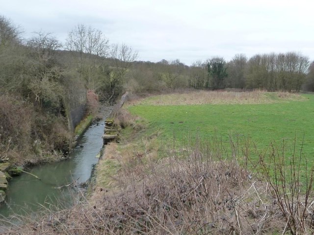
River Dove, upstream of Edmunds Road, Worsbrough
The river once lopped northwards here, but was straightened between 1850 and 1880, hence the high retaining walls.

Creative Commons Licence [Some Rights Reserved]   © Copyright Christine Johnstone and licensed for reuse under this Creative Commons Licence.
Geographical Context: Rivers, Streams, Drainage Place: Worsbrough Primary Subject: River River: Dove other tags: Retaining Wall Click a tag, to view other nearby images.
This photo is linked from: Automatic Clusters: · River [4] ·
1:50,000 Modern Day Landranger(TM) Map © Crown Copyright
+
+
1:50,000 Modern Day Landranger(TM) Map © Crown Copyright
TIP: Click the map for more Large scale mapping
Grid Square
SE3603, 29 images   (more nearby 🔍)
Photographer
Christine Johnstone   (more nearby)
Date Taken
Saturday, 19 March, 2016   (more nearby)
Submitted
Tuesday, 22 March, 2016
Subject Location
OSGB36: geotagged! SE 3606 0350 [10m precision]
WGS84: 53:31.6159N 1:27.4509W
Camera Location
OSGB36: geotagged! SE 3610 0351
View Direction
West-southwest (about 247 degrees)
Clickable map
+
NW N NE
W Go E
SW S SE
Image classification(about): Geograph
This page has been viewed about 39 times
You are not logged in | login | register