Nothing Special   »   [go: up one dir, main page]

2015

SP9114 : Repairing Startops Reservoir (12) Loading the Pontoon Raft with Rocks

taken 9 years ago, near to Marsworth, Buckinghamshire, England
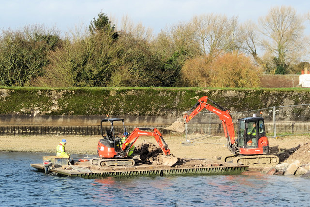
Repairing Startops Reservoir (12) Loading the Pontoon Raft with Rocks
The pile of rocks that been tipped over the reservoir wall is loaded onto the pontoon prior to shipping to the working site.
Next SP9114 : Repairing Startops Reservoir (13) Transporting the Rocks by Raft
Startopsend (or just Startops) Reservoir, near Tring

Startopsend Reservoir was opened in 1817 to provide water for the Grand Junction Canal (now the Grand Union Canal). All but the section of the reservoir adjacent to the Marsworth Reservoir dam are in SP9113. Most of Startopsend Reservoir is in Hertfordshire, but the northernmost part is in Buckinghamshire. It differs from the other reservoirs in the area in that it has very little natural vegetation. It has the Marsworth Reservoir dam on its eastern flank, plus the road on the Tringford Reservoir dam. The Northern edge separates it from the Grand Union Canal and the South West and North West sides are also dams. It takes the overflow water from Marsworth and Tringford Reservoirs and has no direct supply of water.


Creative Commons Licence [Some Rights Reserved]   © Copyright Chris Reynolds and licensed for reuse under this Creative Commons Licence.
Geographical Context: Construction, Development Water resources Primary Subject: Reservoir other tags: Reservoir Pontoon Raft JCB Digger Click a tag, to view other nearby images.
This photo is linked from: Automatic Clusters: · Startop's end Reservoir [18] · Repairing Startops Reservoir [10] · Ship [9] Other Photos: · Repairing Startops Reservoir (11) Builders Offices ·
1:50,000 Modern Day Landranger(TM) Map © Crown Copyright
+
+
1:50,000 Modern Day Landranger(TM) Map © Crown Copyright
TIP: Click the map for more Large scale mapping
Grid Square
SP9114, 333 images   (more nearby 🔍)
Photographer
Chris Reynolds   (more nearby)
Date Taken
Tuesday, 1 December, 2015   (more nearby)
Submitted
Saturday, 19 December, 2015
Subject Location
OSGB36: geotagged! SP 9193 1405 [10m precision]
WGS84: 51:49.0516N 0:40.0638W
Camera Location
OSGB36: geotagged! SP 9195 1402
View Direction
Northwest (about 315 degrees)
Clickable map
+
NW N NE
W Go E
SW S SE
Image classification(about): Geograph
This page has been viewed about 77 times
You are not logged in login | register