Nothing Special   »   [go: up one dir, main page]

2006

SO6138 : Seager Hill Trig

taken 19 years ago, near to Tarrington, County of Herefordshire, England
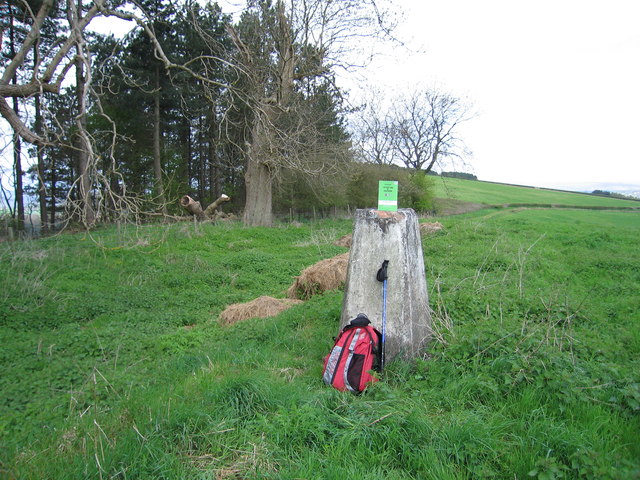
Seager Hill Trig
Seager Hill Trig
Bagged summit which is around the corner from this trig then regained track to gain a telling off from gamekeeper, Get Off My Land, so headed back SE from where I began.
Name: Seager Hill
Hill number: 2865
Height: 272m / 892ft
Area: 38B: West Gloucestershire, Hereford & Worcester
Class: Ma
Grid ref: SO 61365 38950
Summit feature: no feature: ground 3m S of vehicle track
Drop: 167m
Col: 105m SO658257

Creative Commons Licence [Some Rights Reserved]   © Copyright Rude Health and licensed for reuse under this Creative Commons Licence.
Geographical Context: Uplands Grassland Woodland, Forest other tags: Seager Hill Trig Point Marilyn (Rhb) P167 Click a tag, to view other nearby images.
This photo is linked from: Automatic Clusters: · Track [5] · Ground [2] · Trig [2] ·
1:50,000 Modern Day Landranger(TM) Map © Crown Copyright
+
+
1:50,000 Modern Day Landranger(TM) Map © Crown Copyright
TIP: Click the map for more Large scale mapping
Grid Square
SO6138, 11 images   (more nearby 🔍)
Photographer
Rude Health   (more nearby)
Date Taken
Monday, 1 May, 2006   (more nearby)
Submitted
Friday, 15 March, 2013
Subject Location
OSGB36: geotagged! SO 6171 3872 [10m precision]
WGS84: 52:2.7326N 2:33.5830W
Camera Location
OSGB36: geotagged! SO 6172 3872
View Direction
West-northwest (about 292 degrees)
Clickable map
+
NW N NE
W Go E
SW S SE
Image classification(about): Geograph (Third Visitor for SO6138)
This page has been viewed about 71 times
You are not logged in login | register