Nothing Special   »   [go: up one dir, main page]

2012

SD8610 : Curve to the west of Heywood station

taken 12 years ago, near to Heywood, Rochdale, England
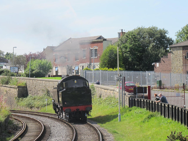
Curve to the west of Heywood station
Immediately west of the station the line curves sharply left. Just out of sight on this photo is the bridge where the two tracks become one SD8610 : 15:05 to Heywood.
East Lancashire Railway (ELR)

The East Lancashire Railway is a steam preservation line , which runs along the Irwell valley from Heywood to Rawtenstall. The original line closed in 1972 and the ELR opened in 1991. The ELR is centred on Bury Bolton Street Station, which was the terminus for the Bury to Manchester line (now part of Metrolink).
Website: LinkExternal link


Creative Commons Licence [Some Rights Reserved]   © Copyright Stephen Craven and licensed for reuse under this Creative Commons Licence.
Geographical Context: Railways Place: Heywood other tags: Railway Curve Click a tag, to view other nearby images.
1:50,000 Modern Day Landranger(TM) Map © Crown Copyright
+
+
1:50,000 Modern Day Landranger(TM) Map © Crown Copyright
TIP: Click the map for more Large scale mapping
Grid Square
SD8610, 135 images   (more nearby 🔍)
Photographer
Stephen Craven   (more nearby)
Date Taken
Sunday, 26 August, 2012   (more nearby)
Submitted
Friday, 31 August, 2012
Subject Location
OSGB36: geotagged! SD 8631 1032 [10m precision]
WGS84: 53:35.3568N 2:12.4971W
Camera Location
OSGB36: geotagged! SD 8637 1031
View Direction
West-northwest (about 292 degrees)
Clickable map
+
NW N NE
W Go E
SW S SE
Image classification(about): Geograph
This page has been viewed about 44 times
You are not logged in login | register