Nothing Special   »   [go: up one dir, main page]

2012

SX4753 : The Hoe, Plymouth, Devon

taken 12 years ago, near to Plymouth, England

This is 1 of 2 images, with title The Hoe, Plymouth, Devon in this square
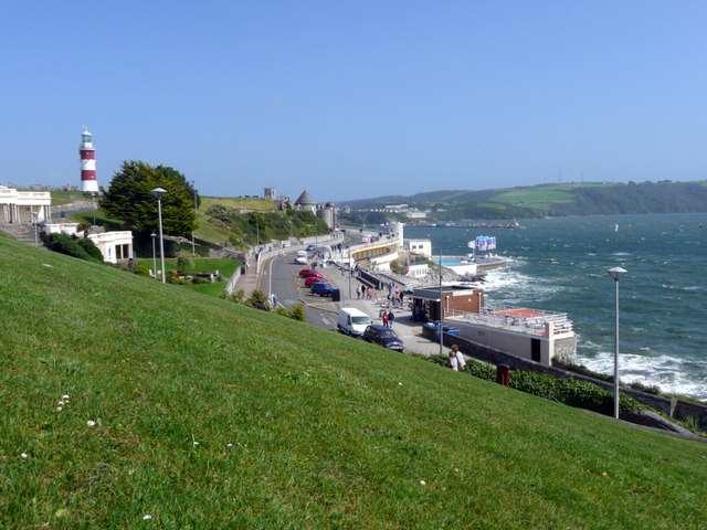
The Hoe, Plymouth, Devon
Looking along the cliffs with Smeaton's Tower to the left and the Mountbatten Pier in the distance.
Smeaton's Tower

Smeaton's Tower was originally built on the Eddystone reef in 1759 and was taken down in the early 1880s.

Now standing at 72 foot high it offers fantastic views of Plymouth Sound and beyond from its Lantern Room.


Creative Commons Licence [Some Rights Reserved]   © Copyright Christine Matthews and licensed for reuse under this Creative Commons Licence.
Geographical Context: Coastal Public buildings and spaces other tags: Smeatons Tower The Hoe Click a tag, to view other nearby images.
This photo is linked from: Automatic Clusters: · Plymouth [653] · Smeaton's Tower [237] Title Clusters: · The Hoe, Plymouth, Devon [2] ·
1:50,000 Modern Day Landranger(TM) Map © Crown Copyright
+
+
1:50,000 Modern Day Landranger(TM) Map © Crown Copyright
TIP: Click the map for more Large scale mapping
Grid Square
SX4753, 1397 images   (more nearby 🔍)
Photographer
Christine Matthews   (more nearby)
Date Taken
Wednesday, 15 August, 2012   (more nearby)
Submitted
Wednesday, 29 August, 2012
Subject Location
OSGB36: geotagged! SX 477 537 [100m precision]
WGS84: 50:21.8445N 4:8.5620W
Camera Location
OSGB36: geotagged! SX 476 538
View Direction
East-southeast (about 112 degrees)
Clickable map
+
NW N NE
W Go E
SW S SE
Image classification(about): Geograph
This page has been viewed about 108 times
You are not logged in | login | register