2014
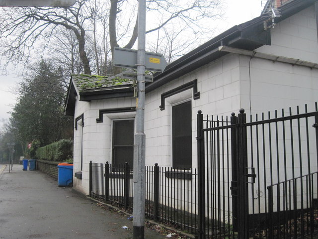
SD8202 : Kersal Bar Toll House, Bury New Road, Salford
taken 11 years ago, near to Broughton, Salford, England
This is 1 of 2 images, with title Kersal Bar Toll House, Bury New Road, Salford in this square

Kersal Bar Toll House, Bury New Road, Salford
On the corner of Moor Lane and Bury Old Road, Kersal, Salford. When I was a student in a nearby hostel, this was a paper shop selling a few food items. Rather than do the 15 minute walk into college for our weekend evening meal, we often bought scones or sausage rolls here to eat in our rooms. It closed some years ago and now stands empty.
A few years ago I discovered it used to be a toll house known as Kersal Bar. When Bury New Road was built in 1831 a gate or bar was erected and travellers had to pay a toll to the turnpike trust to pass through. The toll house had bay window projecting out so that the toll collector had a clear view of the road. By 1848 the local authority had taken over the road and the tolls were abolished. The exterior of the house remains largely unchanged to this day, although it was renovated in 2007 with a two-storey extension being added to the rear. The Toll House is now a Grade II listed building.
A few years ago I discovered it used to be a toll house known as Kersal Bar. When Bury New Road was built in 1831 a gate or bar was erected and travellers had to pay a toll to the turnpike trust to pass through. The toll house had bay window projecting out so that the toll collector had a clear view of the road. By 1848 the local authority had taken over the road and the tolls were abolished. The exterior of the house remains largely unchanged to this day, although it was renovated in 2007 with a two-storey extension being added to the rear. The Toll House is now a Grade II listed building.
See other images of Kersal Bar Toll House