Nothing Special   »   [go: up one dir, main page]

2013

NH3465 : New windfarm from Beinn a' Bhric

taken 11 years ago, near to Corriemoillie, Highland, Scotland
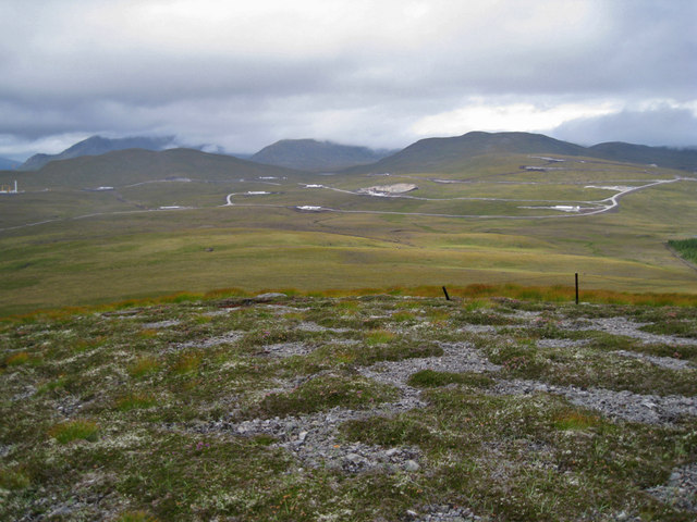
New windfarm from Beinn a' Bhric
The photographer is standing on the wind-blasted summit of Beinn a' Bhric, looking towards Lòn Odhar. Roads have been constructed over the moorland to connect the sites of the wind turbines of Corriemollie windfarm. Towers for the turbines are on site, but lying horizontally. On the far left of the image, one tower is being erected.

Creative Commons Licence [Some Rights Reserved]   © Copyright Richard Dorrell and licensed for reuse under this Creative Commons Licence.
Geographical Context: Energy infrastructure Uplands Place: Beinn a Bhric other tags: Summit View Windfarm Click a tag, to view other nearby images.
This photo is linked from: Automatic Clusters: · Image [2] ·
1:50,000 Modern Day Landranger(TM) Map © Crown Copyright
+
+
1:50,000 Modern Day Landranger(TM) Map © Crown Copyright
TIP: Click the map for more Large scale mapping
Grid Square
NH3465, 10 images   (more nearby 🔍)
Photographer
Richard Dorrell   (more nearby)
Date Taken
Tuesday, 27 August, 2013   (more nearby)
Submitted
Wednesday, 28 August, 2013
Subject Location
OSGB36: geotagged! NH 341 652 [100m precision]
WGS84: 57:38.7764N 4:46.8314W
Camera Location
OSGB36: geotagged! NH 344 651
View Direction
West-northwest (about 292 degrees)
Clickable map
+
NW N NE
W Go E
SW S SE
Image classification(about): Geograph
This page has been viewed about 35 times
You are not logged in | login | register