Nothing Special   »   [go: up one dir, main page]

2013

HU6293 : Vord Hill

taken 12 years ago, 3 km from Houbie, Fetlar, Shetland Islands, Scotland
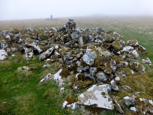
Vord Hill
Vord Hill
Early ferry to Fetlar with Jen, Rick and Tricky parked at school then walked to summit cairn in variable levels of mist.
Name: Vord Hill
Hill number: 1548
Height: 159m / 522ft
Area: 22: Shetland Islands
Class: Ma
Grid ref: HU 62252 93506
Summit feature: cairn 25m E of trig point
Drop: 159m
Col: Sea

Creative Commons Licence [Some Rights Reserved]   © Copyright Rude Health and licensed for reuse under this Creative Commons Licence.
Geographical Context: Uplands Islands Rocks, Scree, Cliffs other tags: Vord Hill Marilyn (Rhb) Trig Point Fetlar Shetland P159 Click a tag, to view other nearby images.
1:50,000 Modern Day Landranger(TM) Map © Crown Copyright
+
+
1:50,000 Modern Day Landranger(TM) Map © Crown Copyright
TIP: Click the map for more Large scale mapping
Grid Square
HU6293, 3 images   (more nearby 🔍)
Photographer
Rude Health   (more nearby)
Date Taken
Thursday, 30 May, 2013   (more nearby)
Submitted
Friday, 26 July, 2013
Subject Location
OSGB36: geotagged! HU 6223 9352 [10m precision]
WGS84: 60:37.2133N 0:51.8881W
Camera Location
OSGB36: geotagged! HU 6226 9352
View Direction
WEST (about 270 degrees)
Clickable map
+
NW N NE
W Go E
SW S SE
Image classification(about): Geograph (First for HU6293) · First in 5 Years (TPoint) (about)
This page has been viewed about 99 times
You are not logged in | login | register