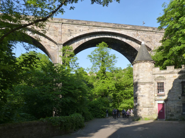
NT2473 : Dean Bridge and 3 Miller Row
taken 12 years ago, near to Edinburgh, Scotland

The building to the right, 3 Miller Row, was originally built in 1913 as squash courts, in Scots Baronial style. At this time squash was a rare pursuit and therefore courts were normally, like this, only built by the wealthy. The building was converted to small workshops in around 1980. Listed Category B.
The Village of Dean lies to the north west of Edinburgh city centre. It is located on the Water of Leith and its name means "deep valley". It has a long history as a milling village, stretching back over 800 years. In 1836 Thomas Telford built the Dean Bridge across the gorge near the village. Since the 1970s it has acquired a reputation for a quiet and tranquil place to live, close to the city centre.
Dean Bridge was built in 1829-32 to the design of Thomas Telford to provide a direct access into Edinburgh from the west, avoiding the tortuous and steep route via Dean Village. Originally planned as a three-arch bridge the design was amended to four arches because of difficulties in find suitable footings for the piers.
The four arches each span 90 feet, and the roadway is carried 106 feet above the bed of the river. The footways are carried on what are in effect separate arches with a span of 96 feet and a rise of only 10 feet compared with 30 feet for the main arches. An innovation was the use of hollow piers to reduce the weight of the structure.
It remains essentially unaltered, although the parapets were raised in 1912 to deter people from jumping off. It is Listed Category A.
Listed buildings and structures are officially designated as being of special architectural, historical or cultural significance. There are over half a million listed structures in the United Kingdom, covered by around 375,000 listings.
Listed status is more commonly associated with buildings or groups of buildings, however it can cover many other structures, including bridges, headstones, steps, ponds, monuments, walls, phone boxes, wrecks, parks, and heritage sites, and in more recent times a road crossing (Abbey Road) and graffiti art (Banksy 'Spy-booth') have been included.
In England and Wales there are three main listing designations;
Grade I (2.5%) - exceptional interest, sometimes considered to be internationally important.
Grade II* (5.5%) - particularly important buildings of more than special interest.
Grade II (92%) - nationally important and of special interest.
There are also locally listed structures (at the discretion of local authorities) using A, B and C designations.
In Scotland three classifications are also used but the criteria are different. There are around 47,500 Listed buildings.
Category A (8%)- generally equivalent to Grade I and II* in England and Wales
Category B (51%)- this appears generally to cover the ground of Grade II, recognising national importance.
Category C (41%)- buildings of local importance, probably with some overlap with English Grade II.
In Northern Ireland the criteria are similar to Scotland, but the classifications are:
Grade A (2.3%)
Grade B+ (4.7%)
Grade B (93%)
Read more at Wikipedia Link
An excursion around the 2013 Geograph conference and AGM in Edinburgh.