Nothing Special   »   [go: up one dir, main page]

2011

TR2666 : Viking Coastal Trail crosses the A28 Canterbury Road

taken 14 years ago, near to St Nicholas at Wade, Kent, England
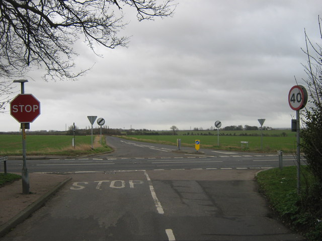
Viking Coastal Trail crosses the A28 Canterbury Road
The long distance cycle trail leads from St. Nicholas at Wade (via Manor Road) and then down to Monkton (via Orchard Lane).
Viking Coastal Trail

The Viking Coastal Trail is a 29-mile route around the Isle of Thanet, the point where Vikings first landed in Britain, keeping as close as is possible to the coast from Reculver, passing through Margate, Broadstairs and Ramsgate to reach Pegwell Bay where the Trail uses an inland loop on quiet lanes through pretty Kentish villages with ancient churches and passes Minster Abbey, one of England’s oldest inhabited buildings founded in 670, to return.


Creative Commons Licence [Some Rights Reserved]   © Copyright David Anstiss and licensed for reuse under this Creative Commons Licence.
Category: Crossroads
This photo is linked from: Automatic Clusters: · A28 [5] · Canterbury Road [2] ·
1:50,000 Modern Day Landranger(TM) Map © Crown Copyright
+
+
1:50,000 Modern Day Landranger(TM) Map © Crown Copyright
TIP: Click the map for more Large scale mapping
Grid Square
TR2666, 51 images   (more nearby 🔍)
Photographer
David Anstiss   (more nearby)
Date Taken
Sunday, 6 February, 2011   (more nearby)
Submitted
Monday, 7 February, 2011
Subject Location
OSGB36: geotagged! TR 268 662 [100m precision]
WGS84: 51:20.9855N 1:15.3715E
Camera Location
OSGB36: geotagged! TR 268 662
View Direction
Southeast (about 135 degrees)
Clickable map
+
NW N NE
W Go E
SW S SE
Image classification(about): Geograph
This page has been viewed about 68 times
You are not logged in | login | register