Nothing Special   »   [go: up one dir, main page]

2007

NN4285 : Summit of An Cearcallach

taken 18 years ago, 3 km from Moy, Highland, Scotland
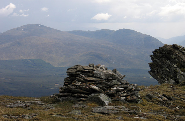
Summit of An Cearcallach
An Cearcallach is a subsidiary summit of Creag Meagaidh; the summit area is grassy with the well made cairn being not quite at the highest point which instead is an inclined rock slab. The mountains in the distance are Stob Coire Sgriodain and Chno Dearg.

Creative Commons Licence [Some Rights Reserved]   © Copyright Trevor Littlewood and licensed for reuse under this Creative Commons Licence.
Geographical Context: Uplands other tags: Mountain Top Cairn Rock Slab Click a tag, to view other nearby images.
This photo is linked from: Automatic Clusters: · Creag Meagaidh [3] · Coire [2] ·
1:50,000 Modern Day Landranger(TM) Map © Crown Copyright
+
+
1:50,000 Modern Day Landranger(TM) Map © Crown Copyright
TIP: Click the map for more Large scale mapping
Grid Square
NN4285, 5 images   (more nearby 🔍)
Photographer
Trevor Littlewood   (more nearby)
Date Taken
Thursday, 31 May, 2007   (more nearby)
Submitted
Friday, 27 January, 2012
Subject Location
OSGB36: geotagged! NN 4222 8541 [10m precision]
WGS84: 56:55.9803N 4:35.6725W
Camera Location
OSGB36: geotagged! NN 4223 8543
View Direction
Southwest (about 225 degrees)
Clickable map
+
NW N NE
W Go E
SW S SE
Image classification(about): Geograph (Third Visitor for NN4285)
This page has been viewed about 48 times
You are not logged in login | register