Nothing Special   »   [go: up one dir, main page]

2011

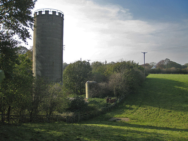
SE7671 : Disused silage tower, Close Farm

taken 13 years ago, near to Swinton, North Yorkshire, England

Disused silage tower, Close Farm
Given the height of the fence, I estimate this to be about 10m in height or approx 33 feet. Silage towers were built in small numbers between the two world wars, but were not generally adopted until the 1960s. They were used for the airtight storage of freshly cut grass and its conversion into silage. Viewed from the footpath to Broughton.
Click the link to see pictures of a similar structure. LinkExternal link

Creative Commons Licence [Some Rights Reserved]   © Copyright Pauline E and licensed for reuse under this Creative Commons Licence.
Geographical Context: Farm, Fishery, Market Gardening other tags: Concrete Structure Disused Silage Tower Dry Valley Public Footpath Click a tag, to view other nearby images.
This photo is linked from: Automatic Clusters: · Disused Silage Tower [6] ·
1:50,000 Modern Day Landranger(TM) Map © Crown Copyright
+
+
1:50,000 Modern Day Landranger(TM) Map © Crown Copyright
TIP: Click the map for more Large scale mapping
Grid Square
SE7671, 43 images   (more nearby 🔍)
Photographer
Pauline E   (more nearby)
Date Taken
Monday, 24 October, 2011   (more nearby)
Submitted
Tuesday, 25 October, 2011
Subject Location
OSGB36: geotagged! SE 76196 71857 [1m precision]
WGS84: 54:8.2149N 0:50.1154W
Camera Location
OSGB36: geotagged! SE 7623 7187
View Direction
West-southwest (about 247 degrees)
Clickable map
+
NW N NE
W Go E
SW S SE
Image classification(about): Geograph
This page has been viewed about 73 times
You are not logged in | login | register