2011
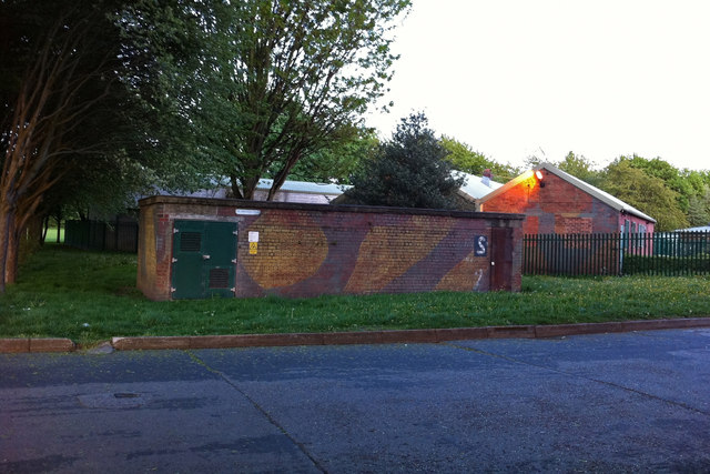
SJ8093 : Camouflaged buildings at Turn Moss Playing Fields, Stretford (former Heavy Anti-Aircraft battery)
taken 14 years ago, near to Chorlton-Cum-Hardy, Manchester, England
This is 1 of 2 images, with title starting with Camouflaged buildings at Turn Moss Playing Fields in this square

Camouflaged buildings at Turn Moss Playing Fields, Stretford (former Heavy Anti-Aircraft battery)
I assumed these buildings formed part of an army camp dating from WWII but I've not been able to find out anything about the site. The large scale OS map from the mid 1950s shows a cluster of buildings looking very much like a military camp, where before the war there had been only a few isolated cottages. The building in front looks like it might have been an air raid shelter but now houses an electrical sub-station while those behind are changing rooms for the surrounding playing fields. It's been suggested to me that this might have been a filming location for 'Yanks', largely shot in the north of England and what remains might be mock ups of an army camp from dating from the 1970s. I'm not yet convinced, having examined the film closely, but the camouflage paint does looks surprisingly fresh. Does anyone have any further suggestions?
Update - January 2013: Steve Thompson, who maintains and updates the Defence of Britain Google Earth overlay, states that "this was actually a Heavy Anti Aircraft Battery. Designation G/H10. The building in the image is probably not a shelter but an ancillary building to the battery". Thanks for the info Steve.
Update - January 2013: Steve Thompson, who maintains and updates the Defence of Britain Google Earth overlay, states that "this was actually a Heavy Anti Aircraft Battery. Designation G/H10. The building in the image is probably not a shelter but an ancillary building to the battery". Thanks for the info Steve.