Nothing Special   »   [go: up one dir, main page]

2010

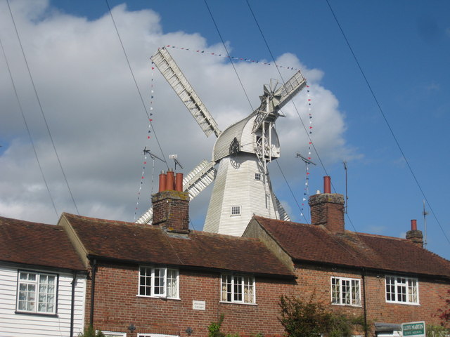
TQ7735 : Cranbrook Union Windmill

taken 15 years ago, near to Cranbrook, Kent, England
This is 1 of 4 images, with title Cranbrook Union Windmill in this square
Cranbrook Union Windmill
Viewed across terraced cottages on The Hill.
Cranbrook Union Windmill

Built in 1814, it is the 2nd tallest windmill and the tallest smock mill in England at almost 22 metres (72 feet) high. It has nine different levels. It is a working mill run by volunteers and is open to the public at weekends, Bank Holiday Mondays and by appointment, from March to September.

The windmill is own by Tunbridge Wells Borough Council who took it over in 1960 and later restored it. For more information LinkExternal link

Grade I listed.

Smock Mills

There are three main types of windmill in Great Britain: post mills, smock mills and tower mills.

The smock mill is of a timber-framed construction with weatherboarded, steeply sloping external walls. It was built on a brick base. A pivoting wooden top with sails moved independently of the main structure so that the sails could be positioned towards the wind. This was controlled by a tail fan.

Windmill article Link


Creative Commons Licence [Some Rights Reserved]   © Copyright Oast House Archive and licensed for reuse under this Creative Commons Licence.
Geographical Context: Historic sites and artefacts Industry Primary Subject: Windmill Category: Windmill > Windmill
This photo is linked from: Automatic Clusters: · Cranbrook Windmill [29] · Hill [28] · Viewed from the Union [6] Title Clusters: · Cranbrook Union Windmill [4] ·
1:50,000 Modern Day Landranger(TM) Map © Crown Copyright
+
+
1:50,000 Modern Day Landranger(TM) Map © Crown Copyright
TIP: Click the map for more Large scale mapping
Grid Square
TQ7735, 187 images   (more nearby 🔍)
Photographer
Oast House Archive   (more nearby)
Date Taken
Tuesday, 4 May, 2010   (more nearby)
Submitted
Tuesday, 4 May, 2010
Subject Location
OSGB36: geotagged! TQ 779 359 [100m precision]
WGS84: 51:5.7103N 0:32.3526E
Camera Location
OSGB36: geotagged! TQ 778 359
View Direction
East-northeast (about 67 degrees)
Clickable map
+
NW N NE
W Go E
SW S SE
Image classification(about): Geograph
This page has been viewed about 144 times
You are not logged in login | register