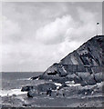
Grid reference SS5147
near to Slade, Devon, England
Coverage
Contribute
Explore gridsquare SS5147
Surrounding area
Maps
Tip: Click the map to open the coverage map

|
Morrisons Daily, 26 High Street, Ilfracombe
|

|
Ilfracombe : Coastal Scenery
Looking across the coast.
|

|
Inside Holy Trinity, Ilfracombe (IV)
|

|
Edge of tidal pool, Tunnel Beaches, Ilfracombe (set of 2 images)
|

|
Entrance to the Beach Tunnels, Ilfracombe
|

|
The Lantern and 48 High Street
The Lantern is a former Congregational (later United Reformed Church) chapel, dating originally from 1728-9, enlarged in 1818-19 and further remodelled in the 1880s. It closed in 1989 following the joining of the congregation with that of... (more)
|

|
Decorated hoarding in Wilder Road
Around a development site next to the public gardens.
|

|
Capstone Hill, Ilfracombe, Devon taken 1960
|

|
Nana Sue's Sun Foods shop in Ilfracombe
Health food shop at 16 High Street. Also in view in June 2017
are Johnny C's Diner and a William Hill betting shop.
|

|
Ilfracombe : Suburb Scenery
Rooftops of the houses in Ilfracombe.
|

|
Masonic Temple, Northfield Road, Ilfracombe
|

|
Ilfracombe High Street after a night of snow.
|
|