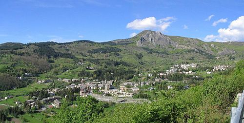
| Santo Stefano d'Aveto | ||
|---|---|---|
| Entidad subnacional | ||
 | ||
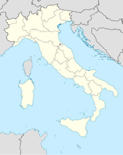 Santo Stefano d'Aveto Localización de Santo Stefano d'Aveto en Italia | ||
 | ||
| Coordenadas | 44°32′52″N 9°27′03″E / 44.547716666667, 9.4507333333333 | |
| Capital | Santo Stefano d'Aveto | |
| Idioma oficial | Italiano | |
| Entidad | Comuna de Italia | |
| • País | Italia | |
| • Región | Liguria | |
| • Provincia | Génova | |
| Superficie | ||
| • Total | 54,78 km² | |
| Altitud | ||
| • Media | 1012 m s. n. m. | |
| Población (1 de enero de 2023) | ||
| • Total | 1,251 hab. | |
| • Densidad | 23 hab./km² | |
| Gentilicio | santostefanesi | |
| Huso horario | CET (UTC +1) | |
| • en verano | CEST (UTC +2) | |
| Código postal | 16049[1] | |
| Prefijo telefónico | 0185 | |
| Matrícula | GE | |
| Código ISTAT | 010056 | |
| Código catastral | I368[2] | |
| Patrono(a) | Nuestra Señora de Guadalupe | |
| Sitio web oficial | ||
Santo Stefano d'Aveto es una comuna de Italia, de 1.251 habitantes, en la Provincia de Génova, distante de la capital regional cerca de 70 kilómetros.

YouTube Encyclopedic
-
1/3Views:16 935346348
-
Elicottero a Santo Stefano d'Aveto - prato Cipolla
-
Transumanza 2017 - Santo Stefano d'Aveto (GE)
-
Santuario della Madonna di Guadalupe - Santo Stefano d'Aveto
Transcription
Monumentos
Evolución demográfica
| Gráfica de evolución demográfica de Santo Stefano d'Aveto entre 1861 y 2001 |
|
Fuente ISTAT - elaboración gráfica de Wikipedia |
Enlaces externos
Datos: Q267032
Multimedia: Santo Stefano d'Aveto / Q267032
- ↑ Worldpostalcodes.org, código postal n.º 16049.
- ↑ «Codici Catastali». Comuni-italiani.it (en italiano). Consultado el 29 de abril de 2017.