Veľká Lomnica | |
|---|---|
Village | |
 Main church in Veľká Lomnica | |
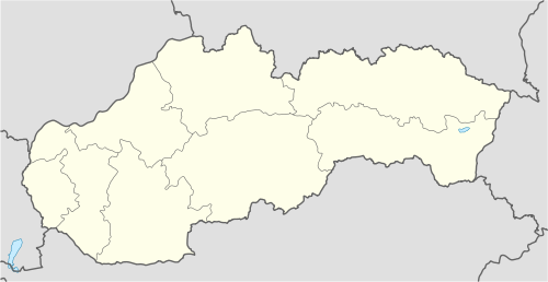 Veľká Lomnica Location of Veľká Lomnica in Slovakia | |
| Coordinates: 49°07′N 20°21′E / 49.117°N 20.350°E | |
| Country | Slovakia |
| Region | Prešov |
| District | Kežmarok |
| First mentioned | 1257 |
| Area | |
| • Total | 19.12[2] km2 (7.38[2] sq mi) |
| Elevation | 647[3] m (2,123[3] ft) |
| Population (2021) | |
| • Total | 5,188[1] |
| Postal code | 059 52[3] |
| Area code | +421 52[3] |
| Car plate | KK |
| Website | www.velkalomnica.sk |
Veľká Lomnica (1808 Welká Lomnica, 1900 Kakaslomnic, 1920 Lomnica, Hungarian: Kakaslomnicl German: Großlomnitz, Rusyn: Велька Ломнїца) is a large village and municipality in Kežmarok District in the Prešov Region of north Slovakia.
YouTube Encyclopedic
-
1/1Views:1 123
-
Príspevok pomáhajúcich profesií k sociálno-ekonomickej integrácii MRK vo Veľkej Lomnici
Transcription
Geography
The municipality lies at an altitude of 639 metres and covers an area of 19.117 km2 . It has a population of about 4,890 people.
Etymology
Lomnica is thought to stem from Slav word Lom - (rock) quarry, the name Veľká (great) has been added in later records to differentiate it from two other settlements with the same name.
History
Archeological finds of fortified settlement of Baden culture in the locality Burchbrich are dated to the end of stone and beginning of Bronze Age, more than 4000 years ago. 70 small animal sculptures were found as well as many tools. In the first century BC, the Celts settle here and during Great Moravia period the Slavs arrive. The village was first mentioned in 1257. The original Slav population was outnumbered by German settlers in the Middle Ages. Before the establishment of independent Czechoslovakia in 1918, Veľká Lomnica was part of Szepes County within the Kingdom of Hungary. From 1939 to 1945, it was part of the Slovak Republic. On 28 January 1945, the Red Army dislodged the Wehrmacht from Veľká Lomnica in the course of the Western Carpathian offensive and it was once again part of Czechoslovakia. In the upheavals of 1945 the Germans were expelled and now the population is formed by Slovak settlers mainly from Pohorela and region of Gorals and also by Roma ethnic group. The well preserved romano-gothic church of Catherine of Alexandria was built in the 13th century and rebuilt in the 15th century. It has unique gothic wall frescoes discovered in the 1950s. The fresco "King Ladislaus fighting the Cumans" is considered one of the most valuable in Slovakia.
Golf course
In 2005 had been opened a nine holes golf course and a year later additional nine holes course circuit, so in 2012 has Veľká Lomnica altogether 18 holes course. Before opening is another nine holes circuit. The village is a place of annual golf tournament Charity Golf Cup.
Famous people
- Ivan Gašparovič, freeman of Veľká Lomnica
- Adolf Burger (1917-2016), a Jewish Holocaust survivor and writer, whose memoirs were made into an Oscar-winning movie
- Georg Buchholtz, geographer
- Ján Hrebík, Czechoslovak Army, resistance movement during World War II
- Samuel Augustini ab Hortis, natural scientist
- Gregor Berzeviczy, economist
- Andor Nitsch (1883–1976), member of the Czechoslovakian Parliament (1925–1938) for the Zipser German party
References
- ^ "Počet obyvateľov podľa pohlavia - obce (ročne)". www.statistics.sk (in Slovak). Statistical Office of the Slovak Republic. 2022-03-31. Retrieved 2022-03-31.
- ^ a b "Hustota obyvateľstva - obce [om7014rr_ukaz: Rozloha (Štvorcový meter)]". www.statistics.sk (in Slovak). Statistical Office of the Slovak Republic. 2022-03-31. Retrieved 2022-03-31.
- ^ a b c d "Základná charakteristika". www.statistics.sk (in Slovak). Statistical Office of the Slovak Republic. 2015-04-17. Retrieved 2022-03-31.
- ^ a b "Hustota obyvateľstva - obce". www.statistics.sk (in Slovak). Statistical Office of the Slovak Republic. 2022-03-31. Retrieved 2022-03-31.
External links
- http://www.velkalomnica.sk Official homepage
- http://www.golftatry.sk/ Golf course Veľká Lomnica
| International | |
|---|---|
| National | |
This Prešov Region geography article is a stub. You can help Wikipedia by expanding it. |