Saint-Nicolas-du-Pélem
Sant-Nikolaz-ar-Pelem | |
|---|---|
 Place Kreisker in Saint-Nicolas-du-Pélem | |
 Coat of arms | |
Location of Saint-Nicolas-du-Pélem  | |
 Saint-Nicolas-du-Pélem 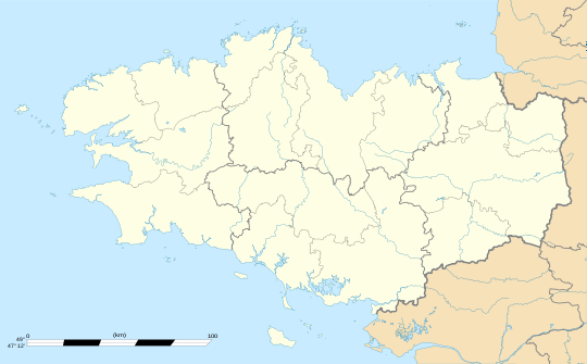 Saint-Nicolas-du-Pélem | |
| Coordinates: 48°18′50″N 3°09′47″W / 48.3139°N 3.1631°W | |
| Country | France |
| Region | Brittany |
| Department | Côtes-d'Armor |
| Arrondissement | Guingamp |
| Canton | Rostrenen |
| Intercommunality | Kreiz-Breizh |
| Government | |
| • Mayor (2020–2026) | Daniel Le Caër[1] |
| Area 1 | 41.04 km2 (15.85 sq mi) |
| Population (Jan. 2020)[2] | 1,555 |
| • Density | 38/km2 (98/sq mi) |
| Time zone | UTC+01:00 (CET) |
| • Summer (DST) | UTC+02:00 (CEST) |
| INSEE/Postal code | 22321 /22480 |
| Elevation | 139–291 m (456–955 ft) |
| 1 French Land Register data, which excludes lakes, ponds, glaciers > 1 km2 (0.386 sq mi or 247 acres) and river estuaries. | |
Saint-Nicolas-du-Pélem (French pronunciation: [sɛ̃ nikɔla dy pelɛm]; Breton: Sant-Nikolaz-ar-Pelem) is a commune in the Côtes-d'Armor department of Brittany in northwestern France.
YouTube Encyclopedic
-
1/4Views:981813342318
-
Saint Nicolas du Pelem | La société Concept Caoutchouc
-
bagad de st nicolas du pelem aout 2009
-
Driving On The D790 Between Plounévez-Quintin & Saint-Nicolas-du-Pélem, Brittany 16th October 2009
-
trail du pelem
Transcription
Population
| Year | Pop. | ±% p.a. |
|---|---|---|
| 1968 | 2,102 | — |
| 1975 | 2,106 | +0.03% |
| 1982 | 2,023 | −0.57% |
| 1990 | 1,922 | −0.64% |
| 1999 | 1,843 | −0.47% |
| 2009 | 1,760 | −0.46% |
| 2014 | 1,688 | −0.83% |
| 2020 | 1,555 | −1.36% |
| Source: INSEE[3] | ||
Inhabitants of Saint-Nicolas-du-Pélem are called pélemois in French.
History
Prehistory
The cairn of Croaz Dom Herry, discovered in 2005, dates to the middle of the Neolithic, but has largely been quarried for its stones, particularly during the late Middle Ages; it has 4 circular funeral chambers, each about 3 meters in diameter, at the end of a long corridor.[4]
Roman period
The town that later became Saint-Nicolas-du-Pélem was built 500 meters from the Roman road linking Vorgium (capital of the Osismii) with Corseul and Aleth (capital of the Coriosolites).
A large plateau surrounded by an artificial moat near Pélinec pond is sometimes considered to be the remains of a pre-Roman fortification of the Gauls,[5] or of a Roman camp, and sometimes as the remains of a medieval camp (Frotier de la Messelière reports having seen foundations for a circular stone tower).
Second World War
A monument to the deceased of Saint-Nicolas-du-Pélem lists 32 individuals who perished during World War II.[6]
Le maquis Tito
During the German occupation, the a group of maquis of the FTP operating in the Côtes-du-Nord, was organized during the spring of 1943 in the rectangular area of Trémargat, Lanrivain, Peumerit-Quintin, and Saint-Nicolas-du-Pélem, led by Louis Pichouron, whose nom de guerre was "Commandant Alain".[7] In January 1944 they took the name of the "Tito Company", after Josip Broz Tito, leader of the communist resistance movement in Yugoslavia, with a team in Saint-Nicolas-du-Pélem led by Théodore Le Nénan.
On November 11, 1943, Théodore Le Nénan killed a member of the Feldgendarmerie in Plouaret; on December 23 Georges Ollitrault attacked a German officer at Loudéac. An attack on the town hall of Saint-Nicodème resulted in the arrest of many members of the group at Trébrivan, and four were shot on May 6, 1944, at Ploufragan.[8]
See also
References
- ^ "Répertoire national des élus: les maires" (in French). data.gouv.fr, Plateforme ouverte des données publiques françaises. 13 September 2022.
- ^ "Populations légales 2020". The National Institute of Statistics and Economic Studies. 29 December 2022.
- ^ Population en historique depuis 1968, INSEE
- ^ Yves Menez and Stéphane Hingant, "Fouilles et découvertes en Bretagne", éditions Ouest-France, INRAP, 2010 [ISBN 978-2-7373-5074-0]. Also Jean-Yves Tinevez et al., "Le cairn de Croaz Dom Herry et ses carrières de schiste (Saint-Nicolas-du-Pélem - Côtes-d'Armor)", revue Gallia Préhistoire, 2012, volume 54-2, pages 191-238.
- ^ Guide des lieux insolites et secrets de Bretagne, par Alain Dag’Naud, éditions Gisserot
- ^ Memorialgenweb.org - Saint-Nicolas-du- Pélem : monument aux morts 1939-1945.
- ^ Louis Pichouron, born on March 27, 1902, see Louis Pichouron,Mémoire d'un partisan breton Louis Pichouron Commandant Alain, Presses universitaires de Bretagne, 1970.
- ^ "LE BOZEC Arsène, Pierre, Marie".
External links
- Base Mérimée: Search for heritage in the commune, Ministère français de la Culture. (in French)
| International | |
|---|---|
| National | |
| Geographic | |
| Other | |