Biesenthal | |
|---|---|
 Parish church | |
 Coat of arms | |
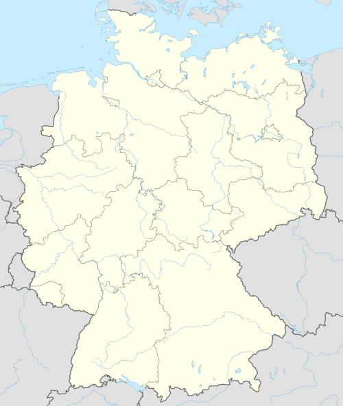
Location of Biesenthal within Barnim district  | |
 Biesenthal  Biesenthal | |
| Coordinates: 52°46′N 13°38′E / 52.767°N 13.633°E | |
| Country | Germany |
| State | Brandenburg |
| District | Barnim |
| Municipal assoc. | Biesenthal-Barnim |
| Subdivisions | 2 Ortsteile |
| Government | |
| • Mayor (2024–29) | Carsten Bruch[1] (CDU) |
| Area | |
| • Total | 60.48 km2 (23.35 sq mi) |
| Elevation | 50 m (160 ft) |
| Population (2022-12-31)[2] | |
| • Total | 6,079 |
| • Density | 100/km2 (260/sq mi) |
| Time zone | UTC+01:00 (CET) |
| • Summer (DST) | UTC+02:00 (CEST) |
| Postal codes | 16359 |
| Dialling codes | 03337 |
| Vehicle registration | BAR |
| Website | www.biesenthal.de |
Biesenthal is a town in the district of Barnim in Brandenburg, Germany. It is the administrative seat of the Amt ("collective municipality") Amt Biesenthal-Barnim.
YouTube Encyclopedic
-
1/5Views:1 7221 683859919930
-
Biesenthal
-
Biesenthal Monkey Rag II
-
Biesenthal Indian Summer Shim Sham Okt 2011
-
Rockende Eiche Biesenthal bei Berlin 2015
-
Biesenthal Blues Shim Sham (VIII)
Transcription
Geography

The town is located on the Finow river, about 31 km (19 mi) northeast of Berlin (centre). The surrounding Biesenthal Basin is part of the Barnim Plateau and the Barnim Nature Park, characterised by numerous kames and glacial lakes stemming from the Weichselian glaciation.
History
In the early Middle Ages, the region was settled by Polabian Slavs. Conquered by the Ascanian margraves of Brandenburg, Bizdal was first mentioned in a 1258 deed. A local parish was already documented in 1265; the present-day fieldstone church was probably erected at this time. The settlement on the Via Imperii trade route to Berlin was vested with market rights by Margrave John V in 1315.
A castle was mentioned in 1337, it was purchased by the Hohenzollern elector John George of Brandenburg in 1577. Its ruins were cleared away after the Thirty Years' War, only ground walls remained. In 1907, a view tower (Kaiser-Friedrich-Turm) was erected on the castle hill.
During the 18th century, the townscape was devastated by several blazes. From 1815 to 1947, Biesenthal was part of the Prussian Province of Brandenburg. The economic development was decisively promoted by the opening of the Berlin–Stettin railway line in 1843. In World War II, a subcamp of the Sachsenhausen concentration camp was located here. The town was occupied by Red Army forces in 1945 and became part of the Soviet occupation zone. From 1947 to 1952, Biesenthal was part of the State of Brandenburg, from 1952 to 1990 of the Bezirk Frankfurt of East Germany and since 1990 again of Brandenburg.
Demography

|
|
|
Politics

Seats in the town's assembly (Stadtverordnetenversammlung) as of 2014 local elections:
- The Left: 6
- Christian Democratic Union of Germany (CDU): 4
- Bürger für Biesenthal (independent): 3
- Alliance '90/The Greens: 2
- Social Democratic Party of Germany (SPD): 2
- Pro Danewitz (independent): 1
Notable people
- Jürgen Paeke (born 1948), gymnast
- Max Schmeling (1905-2005), world boxing champion, frequent guest at the training camp in Biesenthal
- Heinz Graffunder (1926-1994), city architect in Berlin; lived in Biesenthal
- Joachim Ziesche (born 1939), ice hockey player, lives in Biesenthal
References
- ^ Landkreis Barnim Wahl der Bürgermeisterin / des Bürgermeisters. Retrieved 27 June 2024.
- ^ "Bevölkerungsentwicklung und Bevölkerungsstandim Land Brandenburg Dezember 2022" (PDF). Amt für Statistik Berlin-Brandenburg (in German). June 2023.
- ^ Detailed data sources are to be found in the Wikimedia Commons.Population Projection Brandenburg at Wikimedia Commons
External links
- Municipal site (in German)
Towns and municipalities in Barnim district | ||
|---|---|---|
 | ||
| International | |
|---|---|
| National | |
| Geographic | |