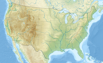
| Ashoken High Point | |
|---|---|
| Highest point | |
| Elevation | 3,081 ft (939 m) NAVD 88[1] |
| Coordinates | 41°55′29″N 74°17′17″W / 41.9248149°N 74.2879263°W[1] |
| Geography | |
| Location | Olive, Ulster County, New York, U.S. |
| Parent range | Catskill Mountains |
| Topo map | USGS West Shokan |
Ashokan High Point is a 3,081 feet (939 m) summit in the Catskill Mountains of New York.[2][3] High Point is the loftiest part of a massif that includes the adjacent Mombaccus Mountain, Little Rocky and South Mountain. The summit can be accessed via the Kanape Brook Trail, which ascends from Ulster County Road 42 to the saddle between High Point and Mombaccus. This trail, named for 19th-century farmer John Canape, was formerly a wagon track connected to the present-day Freeman Avery Road on the south side of the mountain, providing a route between Watson Hollow and Samsonville in the days of the Catskills tanneries.[4] [5] The Gazetteer and Business Directory of Ulster County, N. Y. For 1871-2 referred to the peak as "Shokan Point".[6] It was also known as "Samson," after the Catskill tannery owner for whom Samsonville was named, and is so identified on a 1942 United States Coast and Geodetic Survey benchmark at the summit.[7] Nowadays, Samson Mountain is the name given to a nearby peak above the upper reaches of Rondout Creek.
A lesser summit below the main peak affords an expansive view of the area. It has been called "Little Ashokan," "Round Mountain," "Ashokan Cobble" or "Samson's Nose"[8]).
YouTube Encyclopedic
-
1/3Views:36260421 235
-
Catskills. Streams of Ashokan High Point
-
Final CMRR Removal from Ashokan Reservoir Easement
-
Devil's Path - Catskill Park, NY
Transcription
References
- ^ a b "High Point". Geographic Names Information System. United States Geological Survey, United States Department of the Interior. Retrieved 2013-01-18.
- ^ "Ashokan High Point". Catskill Mountain Club. 2005-08-29. Archived from the original on 6 October 2009. Retrieved 2009-11-12.
- ^ "Ashokan High Point Trail | Peekamoose New York Hikes". Trails.com. 2008-05-17. Archived from the original on 2010-09-10. Retrieved 2009-11-12.
- ^ "Ashokan High Point" (PDF). Archived (PDF) from the original on 7 October 2009. Retrieved 2009-11-12.
- ^ "Catskill Hikes guide, NYS DEC".
- ^ Gazetteer and Business Directory of Ulster County, N. Y. For 1871-2, Compiled and Published By Hamilton Child, Syracuse, NY 1871 (available via Google Books)
- ^ "Ashokan High Point Hike and Map with picture of benchmark"."USGS 1942 West Shokan topo map".
- ^ Sylvester, Nathaniel Bartlett (1880). "Nathaniel Bartlett Sylvester, History of Ulster County, NY, Philadelphia: Everts and Peck, 1880., p. 301"."Caltopo map of Ashokan High Point".

